I want to let my readers know that I am going to focus on one new post every two weeks. There is a lot of effort and research that goes into each post, and I believe some of them will suffer if I have to rush to get one out each week. I’ll save book reviews for the interim weeks (when I have a book finished to review). I have a few projects on the go right now, one of which is preparing a  presentation for International Small Island Cultures Conference in June, applying for another conference and working to get more publications out than last year. Plus, while tourism season is a ways away, I am starting to get booking inquiries, and need to take time to arrange tours for visitors. I hope everyone understands.

If you follow me on twitter (@planecrashgirl) then you may have noticed the odd post or picture about the small railway community of Goobies. I go out there now and then to get away and focus on research and writing. I never really knew much about the area until the past few years; like many Newfoundlanders I didn’t know there was a whole community just behind the Irving.

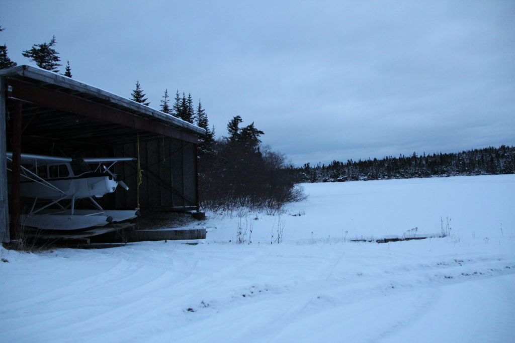
Goobies airport. Photo by Lisa M. Daly, 2011.

Goobies was a railway junction town, but has a little bit of modern aviation history that I would love to know more about.

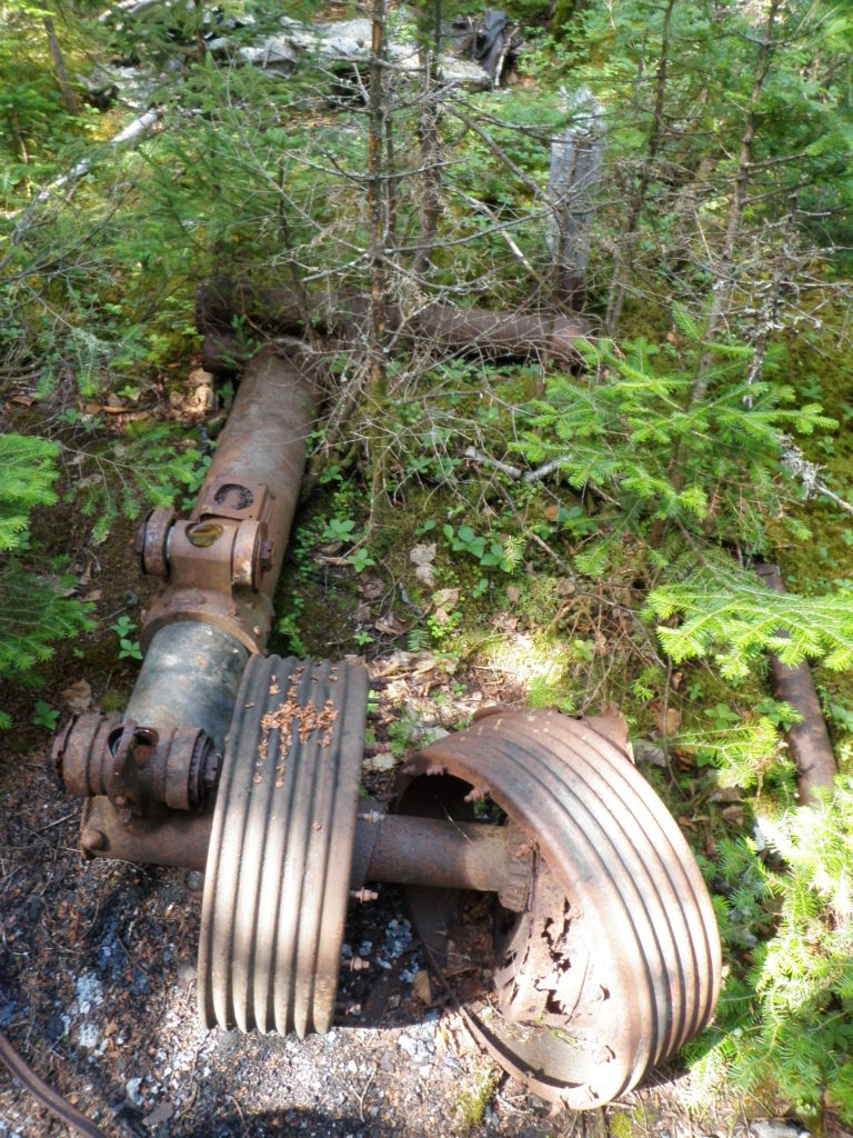
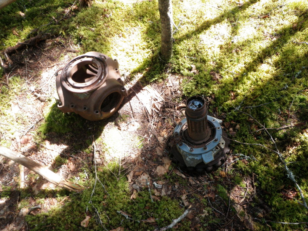
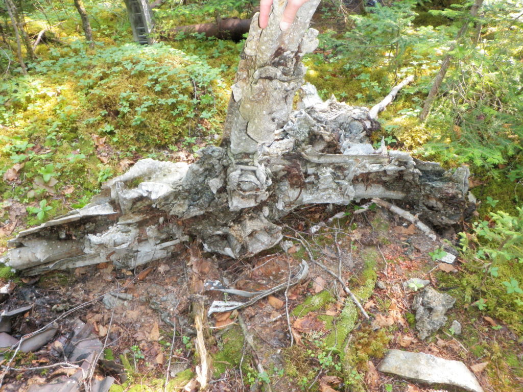
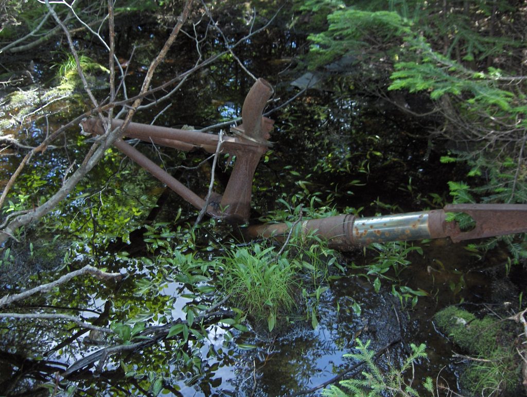
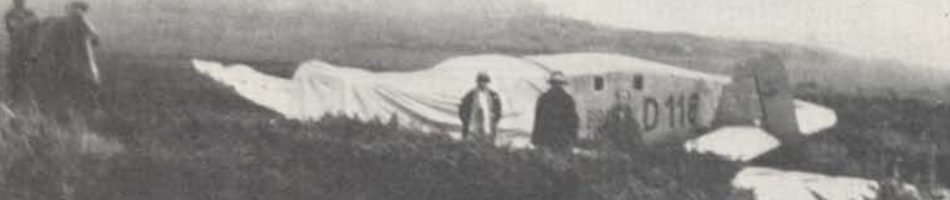
In researching the Beechcraft crash on Bauline Line at the A.C. Hunter Library, I came across an article in the now defunct newspaper the Sunday Express that reported on a plane crash in Goobies Mill, and area near Goobies known for cottages. On 01 September 1990, a Cessna 180 crashed within feet of a trailer and cottage of Old Mill Road at Goobies. The aircraft was carrying three people who were on a short 40km hop from North Harbour Pond to Hungry Gull Pond. They were flying to Hungry Gull Pond to build a cabin.

Goobies Mill Road (or Old Mill Road) runs along Butt Pond alongside the Heritage Run portion of the TCH (Route 210). The crash happened along that area (my source suggests a little further west than this map shows, but I wanted to include Goobies and Route 1 for orientation).

According to the Clarenville detachment of the Royal Canadian Mounted Police (RCMP) at the time of the incident, the pilot, Baxter Slade according to a source of mine, apparently misjudged the wind conditions on takeoff and a sudden wind change blew the aircraft off course.

Sylvia Blundon was a witness to the event. She and 14 other people were outside, sitting at their picnic table in the driveway near their trailer. She told the Sunday Express that her husband was the first one to notice the aircraft when it was about 50 yards from them. The aircraft hit the trees and one of the wings broke off. Blundon reports that it seemed that the pilot noticed the cottage and steered away from the building, coming closer to the trailer. The aircraft “hit the trees and came down right in the middle of the driveway, right in front of the trailer… We were sitting there right in front of the trailer” according to Blundon. Debris was spread up and down the laneway, and it took about an hour for the fire department to arrive and lay down foam to prevent any fire. The pilot was shaken, especially knowing he had almost hit the family, but no one was injured in the incident. The aircraft was destroyed. Both articles state that the Canadian Aviation Safety Board was contacted to investigate, but I have not yet found their investigation report.

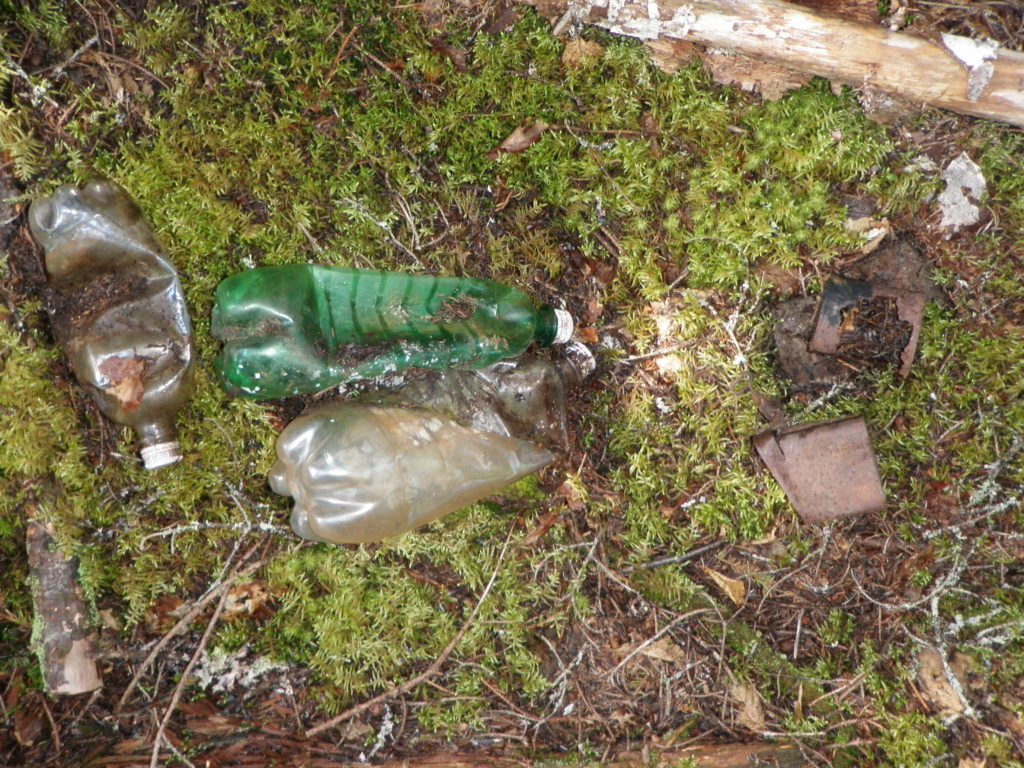
I have not yet visited the site, as I found this article just before the snow started. As I do spend a bit of time in Goobies, I do look forward to looking for this site. It may not be an archaeological site, but I have been told that there is still some evidence in Goobies Mill. I hope if anyone has any further information, or images of the site, they would like to share them.

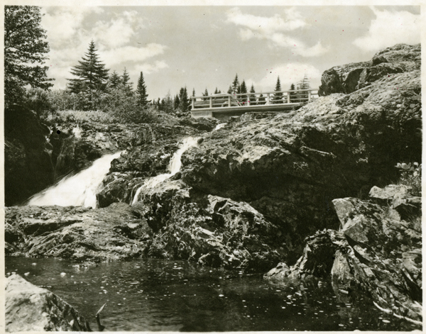
“Falls and river about 7.5 miles from Goobies station”. This bridge is long gone, as is the part of the highway it covered. From PANL [VA 15D-27.5], 1947, Marshall Studios.

Sources:

Unknown
1990 “No injuries in seaplane crash”. The Evening Telegram, 04 September 1990, p.8.

Wangersky, R.
1990 “No one injured in mishap. Small plane crashes within metres of Goobies cottagers”. The Sunday Express, 4 (50), 02 September 1990.

The last post looked at the B-17 that can be found in the Thomas Howe Demonstration Forest in Gander, and discussed what can happen to sites when they are not offered protection but yet are accessible to the public. Prior to the creation of Thomas Howe, the highway was put through the area and the crash site became much more accessible. Due to its accessibility, a lot of the wreckage has been removed. It’s a common theme, and happens whenever a road passes near a site. I’m not saying that everything needs to stay just as it is, but if aircraft material is removed from a site without anything being recorded, the information it can give is lost. This information can give more information about what happened, but if all that is left are a couple of landing gears (figure 1) and bits of steel, the site can really tell us nothing about what happened.

Figure 1: Landing gear with some evidence of fire. Photo by Lisa M. Daly, 2010.

In the Gander area, USAAF B-17 44-6344 can be found between the Thomas Howe Demonstration Forest and the Silent Witness Memorial. It is just off the Trans-Canada Highway, and is relatively accessible. For this reason, there is very little that remains on the site. In fact, there is what looks to be a fire pit where people who were visiting the site stopped and had a lunch, leaving behind their pop bottles (figure 2).

Figure 2: Modern pop bottles on site. Photo by Lisa M. Daly, 2010.

USAAF B-17G 44-6344 crashed 4 August 1944 at 0218GMT. The aircraft made a normal takeoff from runway 23 (235 degrees) en route to the Azores, rose in a steep climb to 200 to 400 feet in a light rain, when the aircraft’s left wing began to drop as if the aircraft were going to make a diving turn. Witnesses described the dip in the wing as resembling a stall (figure 3). The aircraft descended at a 30 to 40 degree angle, and disappeared from view behind the trees. It crashed left wing first and exploded immediately in a 200 to 300 foot high flare (Blackeslee et al. 1944). An eye witness, USAAF navigator Andrew H. Hines, Jr. remembers the crash as follows:

Figure 3: Propeller hub on site. Photo by Lisa M. Daly, 2010.

Air traffic on the North Atlantic crossing was severely impaired. At the time our aircraft was scheduled to cross, planes were beginning to “pile up”, awaiting weather, and it became necessary to move them out. On approximately August 4th we were scheduled to fly the next leg of our trip – Gandar [sic] to Azores.

Our crew was briefed for the flight and we were assigned the position of number 3 for takeoff. As we taxied toward the end of the runway we could see in the east lightning and bad weather from an approaching storm. At the end of the runway we stopped while number 1 took off. He cleared the end of the runway successfully and disappeared into the murk of the approaching bad weather.

Number 2 pulled out on the runway and accelerated for take off. As number 3 we pulled out behind the vacated area and began engine acceleration for our own take off. Number 2 cleared the runway and climbed slightly then heeled over and crashed into the ground. The sky lit up. As number 2 struck and caught fire, our pilot accelerated our engines and we began to roll toward our own take off. We cleared the end of the runway and lifted into the air slightly and flew by the burning wreck of number 2. It was a boiling sea of flames. No one escaped alive. We passed, gained altitude and were immediately in a zone of St. Elmo’s Fire. A ring of sparks marked the tips of our four rotating propellers. Arcs of static electricity began to dance though the aircraft. […] After a few minutes we left the disturbed weather. I had a clear sight of St. John’s which I used as a point of departure for our flight to the Azores (pers. comm. 2 Aug 2013; see table for crew).


Name Serial No. Rank Serial No. Unit Duty Injuries
Oppenheimer, Saul J. 819304 2nd Lt. 819304 15th AF Pilot Fatal
Wampler, Chester C. 767028 2nd Lt. 767028 15th AF Co-pilot Fatal
Hild, Malcolm H. T3200 F/O T3200 15th AF Navigator Fatal
Harrog, David L. 719071 2nd Lt. 719071 15th AF Bombadier Fatal
Faulconer, Warren G. 13143604 Sgt. 13143604 15th AF AEO Fatal
Lawson, Gordon T. Jr. 17072183 Cpl. 17072183 15th AF ROB Fatal
Ruggeri, William 36559279 Cpl. 36559279 15th AF AB Fatal
Shelley, Keith M. 13092412 Cpl. 13092412 15th AF AROG Fatal
Leathers, Maurice E. 37678642 Cpl. 37678642 15th AF AG Fatal
Taylor, Forrest G. 19054972 Cpl. 19054972 15th AF AAG Fatal

Crew list for USAAF B-17 44-6344. Adapted from Blackeslee et al. 1944.

One pilot, Stanley L. Anderson, attempted to contact the control tower to inform them of the crash, but other aircraft interfered with getting through. After trying four times, Anderson went directly to Control Operations and informed them of the crash. The subsequent investigation could not find the cause of the accident, but believed that it was due to an engine stall. The aircraft had had some maintenance done on its flight indicator, but the investigation found that this was not a factor in the crash (Blackeslee et al. 1944).

Figure 4: Melted aluminum. Photo by Lisa M. Daly, 2010.

As previously stated, there is very little left to this aircraft, just a few larger pieces like landing gears. All aluminum and copper has been removed from the site, except for a little bit of melted aluminum (figure 4). According to Frank Tibbo, some of the damage was due to a forest fire in that area, and the scars of that can be seen in how the area has fewer trees than the surrounding forest. It is unknown if the melted aluminum is from the heat of the crash or the later forest fire. That said, some of the wreckage could have been removed when highway crews were putting in a culvert close to the site, or some could be covered by the highway (figure 5).

Figure 5: Wreckage in the drainage ditch near the highway. Photo by Shannon K. Green, 2010.

This site is an example of what can happen to sites if they are accessible and not protected, especially when the cost of scrap metal is high. Most sites I have visited show at least some evidence of trying to remove aluminum, and I have been asked by people “how much copper is still there?” which is usually a red flag to not tell that person where a site is located. While most people will respect a site, especially if there is some form of memorial present, it only takes a couple of people to completely destroy a site.

Measuring the artifacts on site. Photo by Shannon K. Green, 2010.

Sources

Blackeslee, H.B., W.H. Lang and J.E. Stewart
1944      War Department U.S. Army Air Force Report of Aircraft Accident. War Department, Gander, Newfoundland. Ms. available from http://www.accident-report.com/.

Hines, A.H.
2013 Personal communication via email, 2 August 2013

Tibbo, F.
2010 Personal communication