Newfoundland

All posts tagged Newfoundland

My posts have gotten pretty irregular, and they are going to stay that way for a little while. I’m trying to focus on getting more detailed research done and preparing for conferences and the like. I do need to learn to build a better balance between blog posts and in-depth research (such as shorter, less detailed posts) but I haven’t found that balance yet. I’ll get there.

Yesterday I had the pleasure of visiting the Conception Bay Museum for the launch of the poetry book Flightpaths: The Lost Journals of Amelia Earhart by Heidi Greco. I snuggled in with the pirate Peter Easton and enjoyed an imagining through journal entries and poetry of Amelia Earhart’s last days.


Peter Easton, a well-known pirate who often used Harbour Grace as his base. Photo by author.

Greco fell in love with Earhart’s story, and has researched her life and the stories around her disappearance. She uses this information to follow what might have been Earhart’s thoughts as she and Fred Noonan find themselves crashed on a small sandbar, Noonan with severe injuries, and Earhart with a severely injured ankle. Greco allows Earhart to expresses herself with short journal entries, poems, and dreams, exploring her life from the first plane she ever spied, to her marriage to George Putnam, to her childhood and relationship with her sister, to her solo flight from Newfoundland, to her friendships with Katherine Hepburn and Eleanor Roosevelt. Through dreams the wanderings of the mind, Greco explores some of the theories as to what happened to Earhart as she attempted to fly around the equator. She looks at Earhart finding herself in a Japanese prison camp, in a witness relocation scenario, in an institution, and simply as an excuse for the United States to explore the Pacific Islands. Some of the poems and journal entries are so powerful that they will bring a tear to your eye and cause you to mourn the loss of Earhart.


Heidi Greco reading from Flightpaths at the Conception Bay Museum. The camera insisted on focusing on the sunflower, brought by Greco as a reminder of Earhart’s Kansas. Photo by author.

What made Greco’s launch even more powerful was that she choose to launch it in Harbour Grace on the anniversary of Amelia Earhart’s solo trans-Atlantic flight. Most fitting, she read the poem “Grace” about that flight which even mentions “With a gifted thermos of homemade soup tucked beneath my arm,/ I ducked into the cockpit, smiling and waving”, a wonderful touch that I feel shows Newfoundland hospitality at its finest.

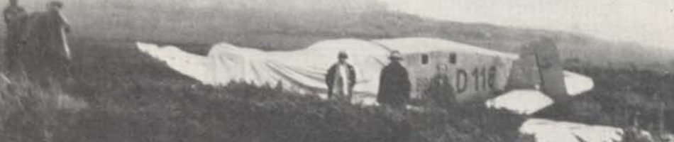
Artifacts of aviation in Harbour Grace, including the log from the Harbour Grace Airfield. Photo by author.

After the reading, it was wonderful to explore the museum. I have been there before, and will be there again. The museum showcases so many important parts of the area’s history, not just Earhart but the Harbour Grace airfield and Harbor Grace’s role in the Trans-Atlantic Air Race, the Kyle and its search for Old Glory. With so much history beyond aviation, the museum looks at the pirates in the area, the fishery, government, and life in Harbour Grace.

Outside the Conception Bay Museum in Harbour Grace. Photo by author.

While at the book launch, I did have the oppotunity to meet many wonderful people from the area whom I only knew through facebook. First, the ladies of The Moose Curry Experience who post great recipes and have helped me with in the field identification with a tweet or two. I was also talking to Florence Button who runs the museums in Carbonear. I will admit I haven’t been into the Railway Station Museum, the Rorke Store or the Post Office Museum, but will make a point of visiting them the next time I am out in Carbonear (which is pretty regularly). Finally, I made arrangements with the wonderful folks at the Conception Bay Museum to let me check out some of their historic documents to get the research ball rolling on a history of Harbour Grace (one that might compliment Challenge of the Atlantic which is now out of print).

A picture of the Harbour Grace Airfield which was taken on a much sunnier day. Photo by author.

Overall, it was a great day, and I enjoyed spending my evening with a glass of whiskey and a wonderful book of poetry.

Of all the sites I researched for my thesis, this one offered the most challenges. It was the most difficult to research, the most difficult to access, and when we got there, the most difficult to map and photograph.

It wasn’t helped by it being an overcast day and the GPS not able to find enough satellite data. Photo by Lisa M. Daly 2010.

The site is located behind the airport, south-east of runway 2 (13/31 degrees or 12/30 during the war era, Tibbo 1997). It is on the edge of a large bog, and I tried to access it from a few different routes. In 2010, trying to take a direct path across the bog, I ended up falling in up to my chest and had a lot of difficulty getting out. I certainly didn’t want to risk my assistant falling in, especially seeing as up to my chest would have been over her head! A second attempt had us skirt the bog in an attempt to get to it that way. In this case, we came to a river. It was pretty fast-flowing, so not easy to just cross. So, one assistant attempted to make us a small bridge with some deadfall to make crossing easier. He fell in and got absolutely covered in river muck. It was a cold day, so I thought it best to try again later. Over the rest of 2010 we reached other sites and recorded those, and the B-25 found itself left for another year.

The river that took out one of my assistants in a 2010 attempt to reach the site. Photo by Lisa M. Daly 2010.

In 2011 I had a different team, and it was a much hotter July. So if we got wet, we’d dry relatively quickly and not have to worry about being wet and cold for hours while trying to work (have to put the health and safety of my team first, of course). It also helped that between 2010 and 2011, GoogleEarth had updated and had better images, so we found what looked to be an old, overgrown, road that should take us somewhat close to the site. Turns out, we couldn’t find a road, but there was a river that took us most of the way, so we hiked up our packs and portaged the survey equipment down the river. With a great team who weren’t afraid to get lost in the woods, we found the site.

The edge of trees from the bog. Aircraft debris was found in both the bog and the trees. Photo by Lisa M. Daly 2011.

Royal Air Force records are not easy to come by. Many of the ones related to specific aircraft were destroyed, and the personnel records (how I found information about the Hudson near the Commonwealth War Graves) can only be accessed by the individual or a descendant. Some websites claim to have the records, but won’t show anything until you pay them. So, that leaves me with online forums and Ocean Bridge by Christie (1995).

What is known is that RAF B-25 Mitchell KJ584 crashed during a night takeoff from Gander on 29 August 1944 at 0342 GMT (Christie 1995; RAF Forum 2012). All crew on board were killed in the crash.

Aircraft debris. Note, the machete visible in these pictures is there for scale (we forgot our scale). Photo by Lisa M. Daly 2011.


Name Rank Service Seat
Kabin, Vladimir John  Captain RAF Transport Command Pilot
Flood, David Sgt. RAF #1550839 Navigator
Sheldrick, Thomas Tweed Sgt. RAF #1311000 Radio Operator

Crew of B-25 Mitchell KJ584, adapted from Christie (1995). Christie has Kabin listed as a Canadian civilian, but according to the RAF Forum and the NBG site, Kabin was RAF Transport Command, meaning he was a civilian who was ferrying aircraft overseas before the RAF took over.

Debris found in the bog showed significant deterioration, possibly due to the rise and fall of the bog during wet and dry periods. Photo by Lisa M. Daly 2011.

From an archaeological perspective, the site offered challenges because unlike the RCAF Lodestar, it wasn’t just on the edge of a bog. It was actually partially in the bog and partially out. In fact, the wet area seemed more like it was a relatively new wet area as it might have been an expansion of the bog after the area had been logged. The pieces scattered around the open area could be easily measured, both by a Garmin GPS or by the surveryor’s level. However, I opted to not use the surveyor’s level because what was in the trees could not be measured that way. Debris was scattered throughout the tightly packed grove of trees, and sometimes larger pieces could not be properly photographed because other trees were in the way.

A segment of fuselage that could not be properly photographed due to the trees. Photo by Lisa M. Daly 2011.

The site itself was well recovered, most likely at the time of the crash. There were no propellers, instruments or other sensitive equipment on site. Most of what could be found were aluminum fragments of the fuselage and some pieces of the frame. The engines had been left on site, but were recovered by 9 Wing Gander a few years previous and laid closer to the road leading to Deadman’s Pond. According to Frank Tibbo (pers. comm. 2011), there were to be (or will be) used by the North Atlantic Aviation Museum.

Engines found near the road to Deadman’s Pond. Photo by Lisa M. Daly 2011.

Given that in looking around the site there was no evidence of an entry point of the aircraft, and that much of the debris in the trees did little damage to said trees, it is highly likely that there was a mid-air explosion which scattered the aircraft around the site. There is no evidence of burning, like at the USAAF B-17 44-6344, and no birch trees which would grow first after a fire, as seen at the RCAF Canso 98107. There are no real markers of visitation to the site, usually in the form of graffiti or litter, but I have talked to people who have been at the site, and who claimed to have removed things from the site (although their story changed and I cannot confirm exactly from which site they visited and removed material).

This section is wrapped around a tree stump, but laid against others, suggesting it may have fallen into the trees. Photo by Lisa M. Daly 2011.

This site offered many challenges, but hopefully if I could ever have access to the personnel records there would be more information and it could give a better idea as to what happened in this incident.

Sources:

Christie, C. A.
1995    Ocean Bridge: The History of RAF Ferry Command. University of Toronto Press, Toronto.

Newfoundland’s Grand Banks (NGB)
2007    Mount Pleasant Cemetery – St. John’s: Field of Honour. (accessed 21 Mar 2017).

RAF Commands Forums
2014    Thread: 440829 – Unaccounted Airwomen & Airmen – 29-8-1944 (accessed 21 Mar 2017).
2011    Thread: Ferry Command Crash Sites in Gander, Newfoundland. (accessed 20 Mar 2017).

Tibbo, F.
2011    Personal Communication
1997    The Best of Aviation: 101 Tales of Fliers and Flying as Published in The Gander Beacon. Creative Book Publishing, St. John’s.

Debris from the wreck of RAF B-25 KJ584. Photo by Lisa M. Daly 2011.